Public Project
The Mangroves Drowning in the Sea
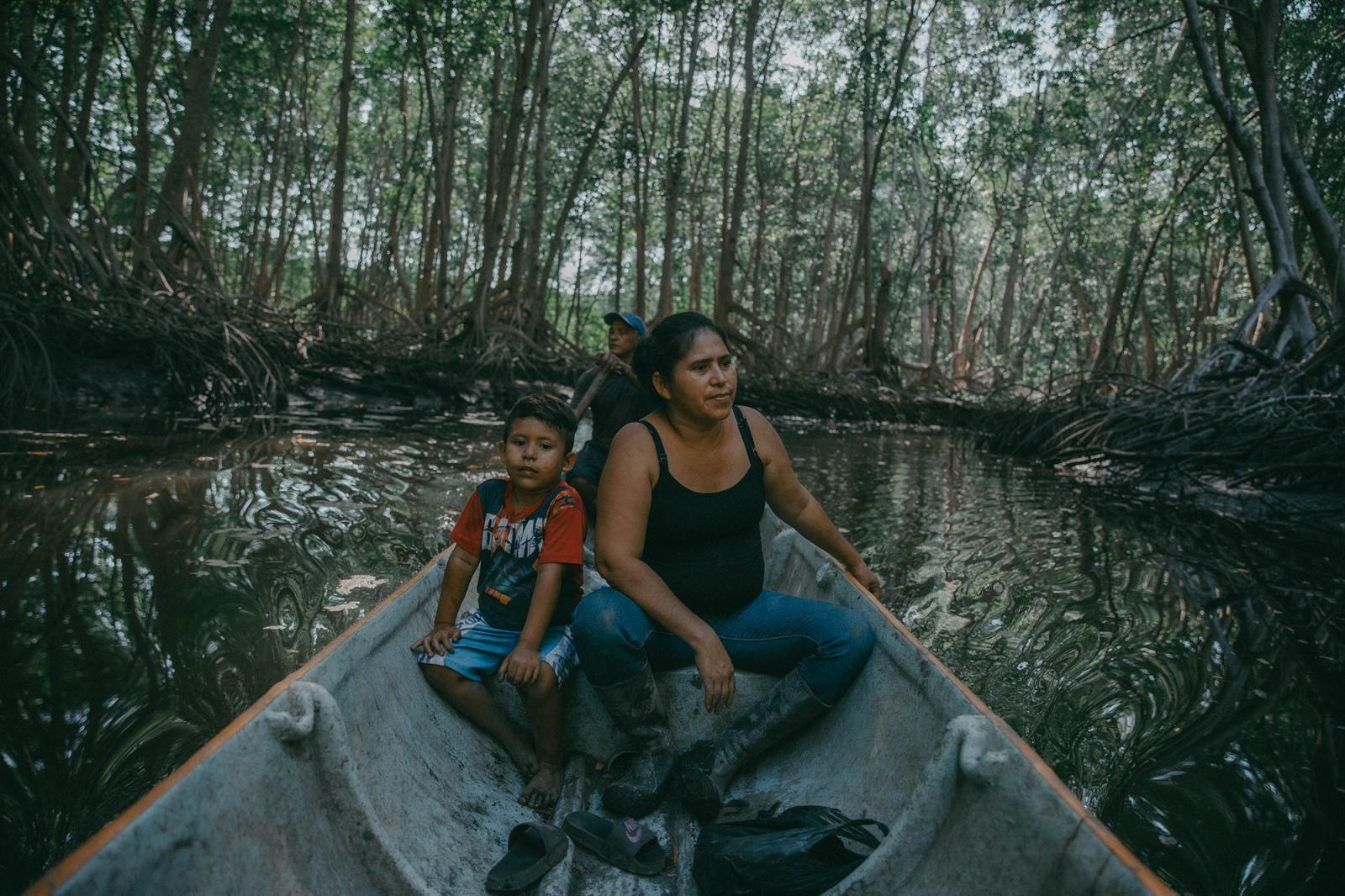
Marta Alicia, a local community leader, navigates the mangrove channels daily with her grandson Diego, who is 4 years old, to teach him how to harvest clams, show him his land, and care for it. Marta and Cándido walk around the small islands carrying a tablet and photographing the trees toppled by the strong winds or fallen over from the fragility of their roots. They don’t want the authorities to think the community has illegally cut the mangrove trees that give them life. Marta, Cándido, and the other 29 families in the community have been scared ever since the mangroves started to die.
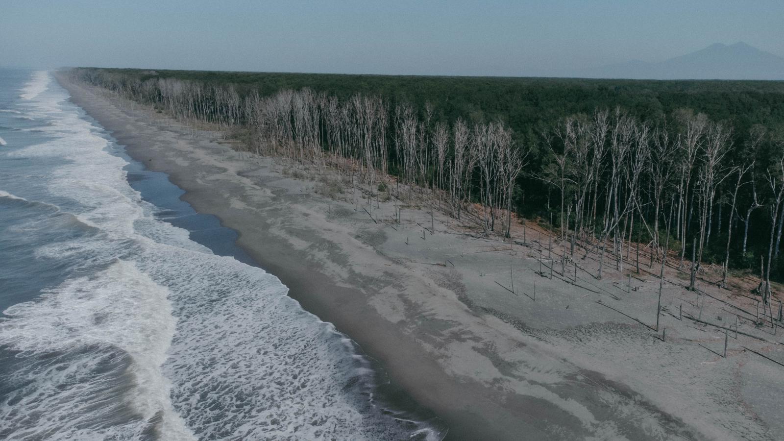
The forest forms part of a brackish swamp that spans more than 20,000 hectares where fresh and saltwater mix and is located on the San Juan del Gozo peninsula on El Salvador’s southern coast, in the region known as the Bajo Lempa, or lower Lempa River valley. The forest here belongs to the largest and most important mangrove ecosystem on Central America’s Pacific coast: the Bahía de Jiquilisco complex in the department of Usulután. In 2001, the community of La Tirana, a small hamlet nestled in the arid lowlands and surrounded by mangroves, was founded on land donated by the Salvadoran Institute of Agrarian Transformation. Over time, the community grew into a small canton about 25 kilometers south of San Marcos Lempa and El Salvador’s Litoral Highway.
Since October 31, 2005, the mangrove has been categorized as a Ramsar site due to its size and capacity to host dozens of species of birds, mammals, and marine life. The Ramsar category is a designation conferred by the Ramsar Convention on Wetlands of International Importance, an international treaty endorsed by UNESCO, which commits member countries to work to prevent the degradation of wetlands. Jiquilisco Bay, because of its sandy surface, is considered the most endangered ecosystem in all of El Salvador, a country that has lost more than 60 percent of its mangroves since 1950.
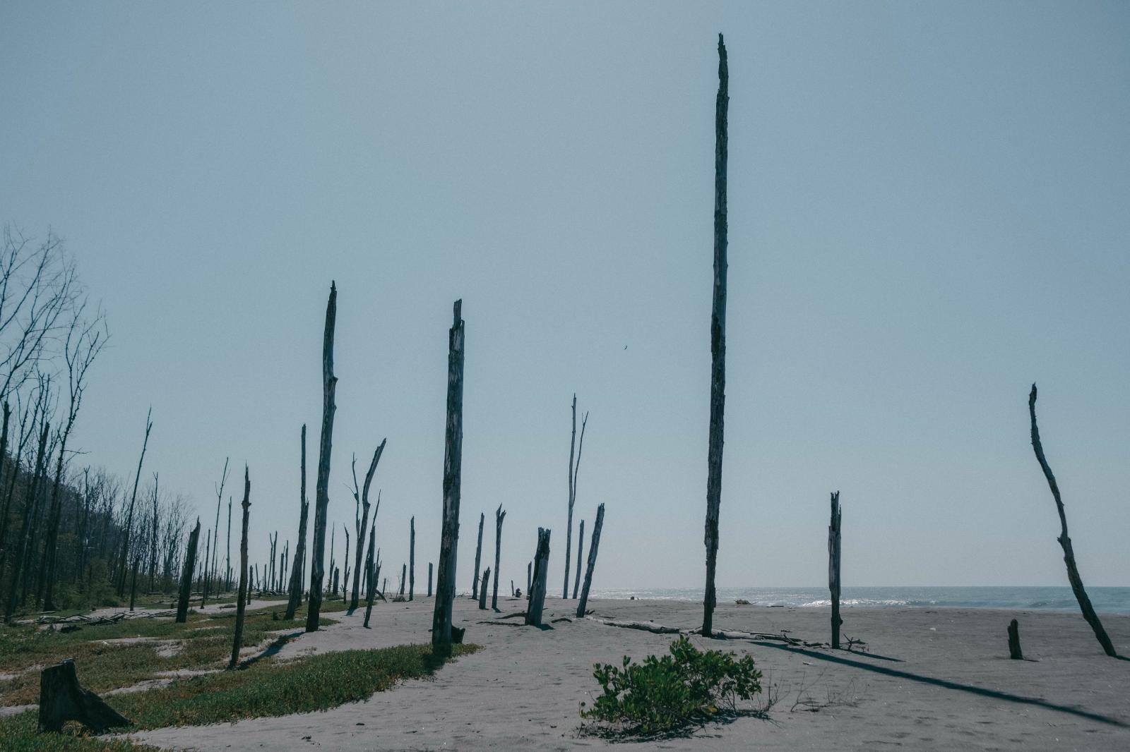
In the case of La Tirana, inhabitants began noticing the loss of hundreds of red mangrove trees, in tandem with the rising tides, more than ten years ago. Organizations like the Asociación Mangle (Mangrove Association) and the Salvadoran Center for Appropriate Technology (CESTA), a chapter of Friends of the Earth International, warn that the rising sea level has negatively affected the mangrove, which is susceptible to changes in salinity and the structure of nearby beaches that suffer from rising sea levels, which have already swept away ranches and houses in the area. Using historical satellite images provided by Google Earth from 2002 to 2023, El Faro confirmed that the sea has been eating away the mangrove.
4,120


